France boundary data
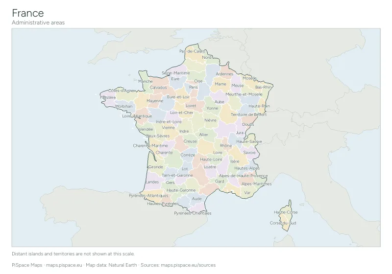
These files give you the outline of France and its 101 administrative areas, ready to drop into QGIS, ArcGIS, Google Earth or a web map.
The country outline comes from Natural Earth’s 1:50m data, which suits maps of a whole country or continent. The administrative areas come from the more detailed 1:10m layer and carry English and local names, ISO 3166-2 codes and Wikidata IDs, so you can join your own figures to them. Everything is in the public domain: you can use, change and share it without asking.
Downloads
Administrative areas (101)
Natural Earth 1:10m · 101 features
About the data
- Coordinate system
- WGS 84 (EPSG:4326)
- Source
- Natural Earth
- Licence
- Public domain
- Formats
- GeoJSON, KML, Shapefile, CSV
Boundaries are generalised for maps at country scale. They follow Natural Earth’s conventions for names and disputed areas, and they are not legal or survey-grade boundaries. The Shapefile ZIP holds the .shp, .shx, .dbf, .prj and .cpg files and a short README; text fields are UTF-8.
Attribute fields
| Field | Meaning | In |
|---|---|---|
name | Name used by Natural Earth | outline, regions |
name_long | Longer English name | outline |
formal_en | Formal English name | outline |
iso_a2 | ISO 3166-1 two-letter code | outline |
iso_a3 | ISO 3166-1 three-letter code | outline |
adm0_a3 | Natural Earth country code | outline, regions |
type | Type of unit (for regions, in the local language) | outline, regions |
sovereign | Sovereign state | outline |
continent | Continent | outline |
region_un | UN region | outline |
subregion | UN subregion | outline |
name_en | English name | regions |
name_local | Name in the local language | regions |
type_en | Type of region in English, such as State or Province | regions |
iso_3166_2 | ISO 3166-2 region code | regions |
adm1_code | Natural Earth region code | regions |
code_hasc | HASC code | regions |
postal | Postal abbreviation | regions |
country | Country name | regions |
wikidata | Wikidata item ID | regions |
latitude | Label point latitude | regions |
longitude | Label point longitude | regions |
Using the files
QGIS: drag the GeoJSON file, or the Shapefile ZIP without unzipping it, onto the map window.
Google Earth: open the KML file from the File menu.
Python: with GeoPandas, read the file straight into a table you can join to your own data:
import geopandas as gpd
regions = gpd.read_file("france-regions.geojson")
print(regions[["name", "iso_3166_2"]].head())
Web maps: Leaflet, MapLibre and OpenLayers all read GeoJSON directly. The files use longitude and latitude, so no reprojection is needed.
Data from Natural Earth (public domain). No credit is required; a link to this page is appreciated. About the source
All boundary data